Blippar's Urban Visual Positioning System
Precision navigation powered by Computer vision
Introduction
According to Wikipedia, positioning system is "a mechanism for determining the location of an object in space". There are many positioning systems that exist. But I would like to talk about GPS first. Global Positioning System is a satellite-based radio navigation system that provides geolocation and time information to a GPS receiver anywhere on or near the Earth. GPS works on the principle of 'trilateration' where three satellites are used to trace the object location and fourth satellite is used to confirm the location of each of space satellites.
However, there is an issue with this approach. The approach assumes that there is a clear line of sight between the object to be tracked and the satellites. This assumption stands true in most of the cases. But, there are locations where there is a cluster of high rise buildings (For example, downtown in Chicago), the satellite signals do not properly reach the receiver. This results in inaccuracy in the determination of the location of the user [called as Urban Canyon problem]. There are many proposed solutions to this issue. I am going to talk about Blippar's Urban positioning system.
Blippar's Urban Visual Positioning System
- Blippar's Urban Visual Positioning System offers city scale positioning services with higher accuracy as compared to GPS.
- The system uses computer vision to accurately estimate the location and orientation of the user with respect to the surrounding environment.
- Designed to power the new generation of location-based AR
Blippar's Visual Positioning System uses GPS to estimate the absolute position of the user, and Visual Inertial Odometry (VIO) to track their local movement. It smoothly integrate GPS and VIO throughout the entire experience by building on the ARCL library, which uses Apple’s ARKit for VIO and Core Location for GPS.
While previous AR solutions relied on GPS and compass to localize the user in a city, the use of Computer Vision brings several advantages. The GPS location error in cities can be over 16m, it degrades where the urban landscape causes bad GPS reception, and varies across mobile devices with different GPS sensors. The Urban Visual Positioning System, on the other hand, achieves a location error of only a few meters and has more than double the accuracy of a standard GPS, it performs consistently across a wide variety of urban scenarios, and across different mobile platforms. Thanks to the principled use of visual cues and geometric reasoning, the Urban Visual Positioning System can self-assess its accuracy much more robustly than a standard GPS system and can take location-based AR to new levels of engagement, for example virtual departure boards in front of train stations, interactive guides in front of famous landmarks, or even a virtual menu hanging on the wall of a restaurant. It can help navigate a complex intersection or find a hidden restaurant by overlaying virtual roads and directions onto the physical world, or engage users in AR treasure hunts with virtual cues accurately hidden at physical locations. Moreover, Urban Visual Positioning naturally integrates with modern systems for tracking the local, relative movement of a phone, like Apple’s ARKit, resulting in very smooth and immersive AR experiences.
After releasing the technology, Blippar released its implementation in the form of an iOS application called ARCity - AR Navigation. The app comes with three layers of information:
- AR basic navigation: A visualisation of walking routes in augmented reality
- Enhanced map content: AR overlays of information related to user’s location - for example streets and points of interest
- Urban visual positioning: Recognition, positioning, and directional information via computer vision. ( Only available in Central London, San Francisco and Mountain View)
Applications
Since a camera is involved in the usage of technology, there can be many possible applications:
- Tourism: The technology can be used to create immersive city guides and detailed local information. User needs to point the phone camera at some famous landmark and the application will provide in depth information about that place. The guidebook industry alone is a market currently worth $90 million, according to industry research group, Nielsen
- Immersive Navigation: For the people who like to explore the city on their own. This technology can help them navigate and learn around the city. Consider you are taking a walk around in a typical marketplace. By looking at everything via the app, you can find out about the today's specials of the restaurants, items on sale in the shops, upcoming events in the bars etc at a single place.
- Marketing: AR City promises to let people hold up their smartphones and instantly see digital overlays that point out nearby shops, restaurants, offices, street signs and points of interest, providing a sort of digital city guide for tourists. The next step in this evolution could likely let retailers and restaurants buy virtual ads that reach users as they walk or drive through a neighbourhood. The company has developed a separate module for this and have created mini-interactive modules for their clients. For example, Jaguar is the early adopter of their technology and Blippar has integrated the virtual tour of its Range Rover
- Licensing: This technology is open to be licensed to other companies to make products for their specific use cases.
- Gaming: The technology can be used to create location-based AR games like Treasure Hunt where the people have to visit different places to collect clues.
Concerns
The technology has no doubt many applications. However, there are many issues that will hinder the adoption/ growth of the technology. The few of them could be:
- Safety: The overlays on the object might hide some information. Also, if the person is constantly looking into the screen, he/she might not be completely aware of the surroundings and can be more susceptible to accidents. This was one of the biggest learning from the experience of people playing Pokemon Go
- Device battery: Since, the technology requires the use of a camera, which is one of the biggest consumers of mobile device power. Hence, prolonged use will result in fast drainage of battery and reduced battery life.
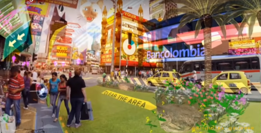
- Content Clutter: With so much information available to be presented. There is a huge problem of arrangement of information. There is a probability that in order to showcase information the whole view is overlaid with different types of data and user is not able to look at anything at all. This is the screenshot taken from the presentation by Blippar's CEO Ambrish Mitra in web summit 2018 where he discussed the use of pull based information as compared to push-based content.
- Competition: So far, Blippar is the only player in the augmented reality-based navigation segment. However, Google has recently announced integration of augmented reality into Google maps which will result in very tough competition for Blippar
Hands on experience
Chicago is not covered for Urban Visual Positioning technology for the application. Hence, I was only able to check the basic AR based navigation. When app starts, it requires user assistance in locking the exact position of the user. When, the position is locked, it will show you the point of interests like house numbers, street names,building names etc. The application was fast in response time to show up the content related to the surroundings. There were few instances when the position of the street was skewed. You can enter your destination into the app and the app shows a guided navigation view for the user. Following is the video of me navigating from Jackson street to Artopolis, a nearby cafe and bakery.
Conclusion
Urban positioning system along with Augmented Reality technology is an exciting combination. Like every new technology, it has to follow a typical acceptance curve. Augmented reality is experiencing high usage among consumers and developers and is predicted to value USD 30 billion by 2023. Hence, it is right time for the company to cement its footing in this sector. By removing certain caveats in the design of the application, this technology can be one of the most useful companions in urban areas
References
- https://en.wikipedia.org/wiki/Positioning_system
- https://en.wikipedia.org/wiki/Global_Positioning_System
- https://www.tracking-system.com/news/3-tracking-system-information/992-gps-device-accuracy-in-city-environments-.html
- https://www.blippar.com/blog/2017/08/02/introducing-urban-visual-positioning-breakthrough-location-based-ar
- https://www.blippar.com/blog/2017/11/06/welcome-ar-city-future-maps-and-navigation
- https://www.mobilemarketer.com/news/blippar-tests-ar-app-to-help-users-navigate-cities/510353/
- http://heraldkeeper.com/market/augmented-reality-ar-market-valuation-usd-30-billion-2023-technological-advancements-stimulate-global-ar-market-2017-2023-127907.html